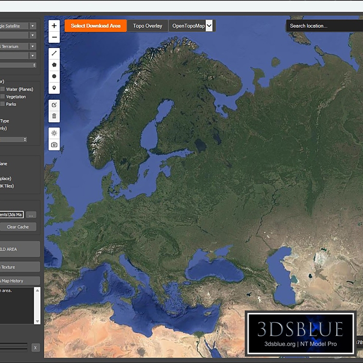
MaxGIS is a tool for 3ds Max designed for rapid environment creation. The script allows you to highlight the desired area on an interactive world map directly within the program's interface and generate a ready-made 3D scene with a single click. This is an indispensable solution for architectural visualization, urban planning, and landscape design tasks. Key features: Loading vector geometry (OpenStreetMap): Generation of 3D buildings, road splines, water bodies, parks, railways, and power lines. Satellite imagery and textures: Loading maps from several providers (Google, Yandex, Esri, OSM, Carto), support for tile cutting (8K) to improve map readability in high resolution in the viewport. 3D terrain: Building landscape mesh based on elevation maps. Rulers for measuring areas and distances, terrain profiles along a straight line. Compatibility: tested from 3ds Max 2021 and newer. Usage rights and disclaimer: This tool is provided "as is". The script serves as a bridge between 3ds Max and public web services. The author of the script is not responsible for the functionality of third-party APIs, changes in their algorithms, or download limits on tiles. Data rights: All satellite imagery, topographic data, and geometry belong to their respective owners (Google, Yandex, Esri, OSM Foundation, etc.). The use of generated maps and images for commercial purposes must be strictly in accordance with the terms of service of the chosen provider. Vector data from OpenStreetMap is distributed under the open ODbL license.